
Morrisburg Then and Now plaque unveiled
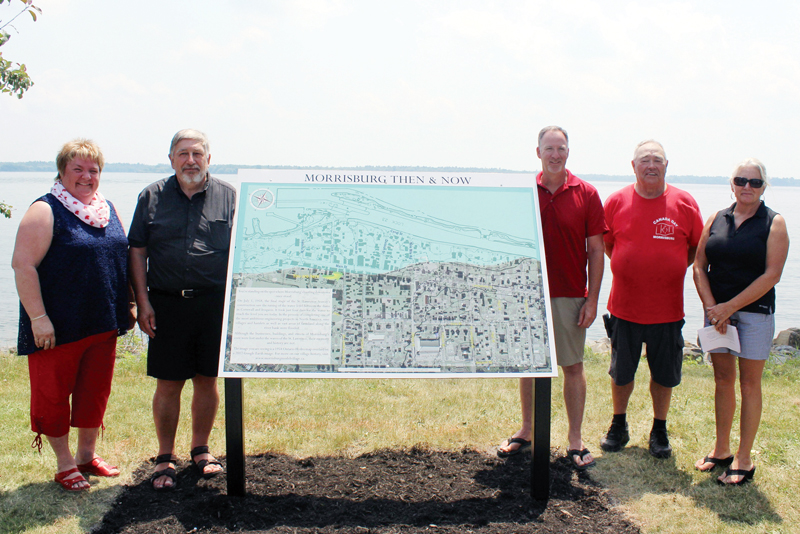
From the left, South Dundas Mayor Evonne Delegarde, John Gleed, South Dundas councillor Marc St. Pierre, Morrisburg Waterfront Advisory Committee co-chairs Keith Robinson and Maggie Harvey are pictured a few moments after the Morrisburg Then and Now plaque was unveiled on July 1. Thompson Goddard photo
Carolyn Thompson Goddard
Record Correspondent
MORRISBURG – Amid the celebrations associated with Dominion Day on July 1, 1958 celebrating Canada’s Confederation, many residents watched and waited along the Front in Stormont and Dundas counties as the final chapter in the creation of the St. Lawrence Seaway was written. What was expected to be an immediate flooding of the now vacant land where once animals and plants grew, where generations of people lived and worked began as a trickle before becoming a rush of water changing forever the coastline and history of the area.
On the 60th anniversary of Inundation Day, as July 1 is also known, a small group of people gathered along the waterfront in Morrisburg to witness the unveiling of a plaque, entitled Morrisburg Then and Now. A press release issued by the Municipality of South Dundas, prior to the event, explained how “This sign is a pictorial reminder of what Morrisburg once was, and what was lost, and will mark an important historical focal point in the park.”

Morrisburg resident John Gleed “designed, created and sponsored” the plaque which features an overlay of the 1954 Ontario Hydro map on a 2017 Google Earth image of this section of the community as well as information on the St. Lawrence Seaway and Power Project.
During the short ceremony, Gleed thanked members of the Morrisburg Waterfront Advisory Committee, council and staff of the municipality as well as the other community supporters of the project. South Dundas Mayor Evonne Delegarde, on behalf of the council, residents and staff of the municipality, extended her thanks to the Morrisburg Waterfront Advisory Committee and John Gleed for their work in preserving this part of the history of South Dundas.
More information and pictures associated with the history of this area can be found at www.stlawrencepiks.com as well as www.morrisburgmodelvillage.ca. These sites contain maps, photography and information associated with both the St. Lawrence River and the Morrisburg/South Dundas region.


